
Pictured Rocks take Planning
"Winging it" is no longer a viable option.

Originally published in the Battle Creek Enquirer on July 23, 2006. Updated to reflect changes since its first publication.
Planning what to do at Pictured Rocks National Lakeshore will likely result in spirited debate, compromise, and eventually a workable plan—especially if two or more people are involved in the decision-making process. Pictured Rocks offers an assortment of activities, and it is fair to say there is something for everyone: magical waterfalls, miles of remote beaches, towering geological formations, kayaking, fishing, and extensive hiking trails.
Because of this wide variety of opportunities, you may need to prioritize and compromise, particularly if your time is limited.
Waterfalls
Some waterfalls can be seen without leaving the comfort of your car. Such is the case with Alger Falls, located on M-28 just north of its junction with M-94, on the east side of the road.
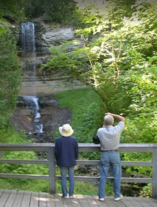
Munising Falls
Others, such as Spray Falls, can only truly be appreciated from a boat. There is a hiking trail to the falls—I have done it—but it is not for the faint of heart. I recommend viewing Spray Falls from the cruise, as hikers can only glimpse the water plunging over the precipice through a tangled web of alder. People have died attempting to reach the falls on foot. Take the boat.
More accessible waterfalls include Sable Falls, Munising Falls, and Wagner Falls, all of which are reached by short walks from nearby parking areas.
If you are willing to hike several miles, Miners Falls, Chapel Falls, and Mosquito Falls reward visitors with impressive views directly from the trail.
Which waterfall is best? That question is as difficult to answer as “Which is your favorite child?” Each has its own distinctive character. At the end of this article, an itinerary outlines an efficient way to visit several waterfalls in one day.
Sights
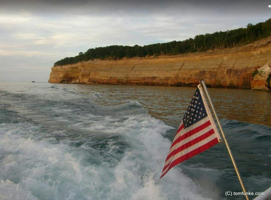
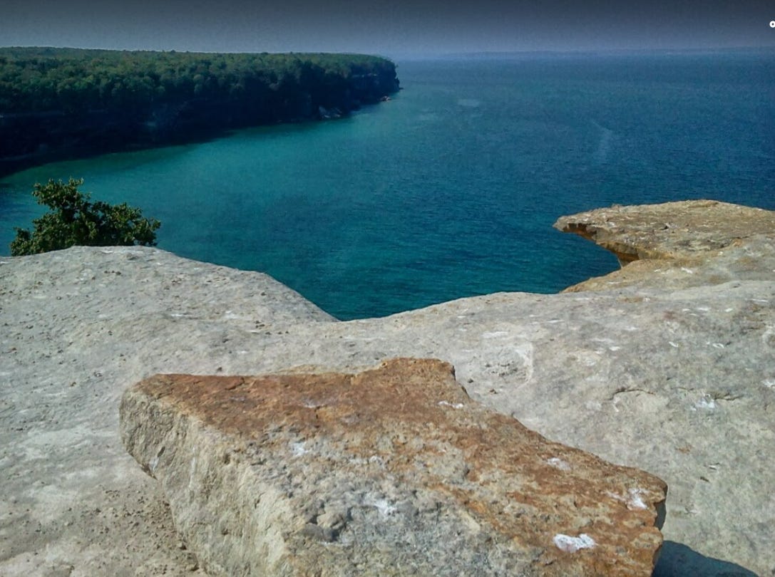
The most sought-after view is Miners Castle, particularly since one of its famous “turrets” collapsed into Lake Superior in April 2006. The formation provides a bona fide lesson in geology, especially when one recognizes that it is more than an oddly shaped mass of rock. Visitors are observing geological history recorded in sedimentary rock and related deposits. Remarkably, these sediments were deposited across broad periods of geologic time. Except for glacial till covering the area, many of these formations are estimated to be 500–800 million years old.
A stop at either visitor center—Munising Falls or Grand Sable—will provide detailed explanations of the area’s geology. It is surprising how many visitors stop at Miners Castle but never take the time to learn what they are actually seeing.
If you are fond of sand dunes, visit Log Slide and Grand Sable Dune. Dunes are unusual along Lake Superior, and both locations provide an opportunity to appreciate the forces of nature that created and continue to shape these immense sand formations.
For those with the courage to take a dip in the coldest of the Great Lakes, three beaches are available: Miners Beach, Twelve Mile Beach, and Sand Point Beach. Keep in mind that Lake Superior rarely warms above 45°F. A better chance for relatively warm water can be found at Mosquito Beach, where shallow, protected conditions may allow temperatures to reach 70°F after several calm, sunny days. However, reaching Mosquito Beach requires a 4.5-mile round-trip hike—but the effort is well worth it.
Camping
Backpackers traveling the 45-mile segment of the North Country Trail within the park will find numerous backcountry campsites. The days of simply arriving and obtaining a permit are long gone; reservations must now be secured in advance at recreation.gov. Even if you visit a ranger station in person, you will likely be directed to reserve online.
The same applies to drive-in campgrounds at Beaver Lake, Twelve Mile, and Hurricane River. Twelve Mile’s thirty-six sites were recently ranked Michigan’s number-one campground by Condé Nast Traveler, providing impressive recognition.
Hurricane River and Beaver Lake offer twenty-one and eight sites, respectively.
Tips
Hotels are expensive and often book far in advance.
Many motels in the area accept reservations by phone; locating contact numbers and calling directly may yield results.
The Pictured Rocks Cruise typically does not sell out far in advance; however, the sunset cruise is popular and should be reserved in advance.
Additional options include the Shipwreck Cruise and the Riptide Ride, a faster and more adventurous experience.
Unless you are a highly experienced sea kayaker with the proper equipment, do not kayak Lake Superior on your own. Numerous tour companies provide trained guides, proper equipment, and safety protocols to ensure a safer and more enjoyable experience.
Several state and national forest campgrounds in the surrounding area operate on a first-come, first-served basis.
Numerous Airbnb and VRBO properties are also available.
The author operates a hostel in nearby Germfask, less than one hour from either end of the park (hikerhostelgermfask.com).
Many short day-hike opportunities exist; consider the Sand Point Trail’s looped boardwalk.
The Chapel, Mosquito, and Grand Portal hikes share the same parking area. Arrive early—not 11:00 a.m. early, but closer to 7:00 a.m.—as the lot fills quickly and roadside parking becomes necessary.
Waterfalling Strategy
Want to visit numerous waterfalls in a single day? Consider the following sequence:
Scott Falls
Au Train Falls
Wagner Falls
Alger Falls
Munising Falls
Miners Falls
Mosquito Falls
Chapel Falls
Sable Falls
Horseshoe Falls (gift shop location)
Complete the experience with a cruise to view Bridalveil Falls and Spray Falls from the water.
https://www.nps.gov/piro/planyourvisit/index.htm
https://picturedrocks.com/our-stories/planning-your-pictured-rocks-adventure/
https://www.travel-mi.com/Pictured-Rocks.html
https://mymichiganbeach.com/pictured-rocks/
AI disclaimer: Grammarly was used to check for spelling, punctuation, and grammar. ChatGPT was used to convert the article to the Chicago Manual standards. The ideas, words, and writing are solely the author’s.
We also created a map of waterfalls you could do in a day and even get ice cream at Mama Cow!
https://maps.app.goo.gl/L4wMiUAXkTrXwDks9
Another map of the falls, without directions!
https://www.google.com/maps/d/edit?mid=1OJfW4moAv6QllCm_FCVvSSMGOQ5406o&usp=sharing